


Worcester Precinct 03-003, Worcester County, Maryland
About
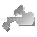
Outline

Summary
| Unique Area Identifier | 593286 |
| Name | Worcester Precinct 03-003 |
| County | Worcester County |
| State | Maryland |
| Area (square miles) | 9.98 |
| Land Area (square miles) | 9.55 |
| Water Area (square miles) | 0.43 |
| % of Land Area | 95.70 |
| % of Water Area | 4.30 |
| Latitude of the Internal Point | 38.33811170 |
| Longtitude of the Internal Point | -75.17072800 |
Maps


Graphs
Select a template below for downloading or customizing gragh for Worcester Precinct 03-003, Worcester County, Maryland


Neighbors
Neighoring Voting District (by Name) Neighboring Voting District on the Map
- Voting Districts not defined, Worcester County, MD
- Worcester Precinct 02-003, Worcester County, MD
- Worcester Precinct 03-001, Worcester County, MD
- Worcester Precinct 03-002, Worcester County, MD
- Worcester Precinct 04-003, Worcester County, MD
- Worcester Precinct 05-001, Worcester County, MD
- Worcester Precinct 05-002, Worcester County, MD
- Worcester Precinct 06-002, Worcester County, MD
Top 10 Neighboring County Subdivision (by Population) Neighboring County Subdivision on the Map
- District 3, Sinepuxent, Worcester County, MD (9,134)
- District 5, Ocean Pines, Worcester County, MD (7,722)
- District 2, Central, Worcester County, MD (7,112)
- District 6, Northern, Worcester County, MD (7,108)
- District 4, Western, Worcester County, MD (6,487)
Top 10 Neighboring Place (by Population) Neighboring Place on the Map
Top 10 Neighboring Unified School District (by Population) Neighboring Unified School District on the Map
Top 10 Neighboring State Legislative District Lower Chamber (by Population) Neighboring State Legislative District Lower Chamber on the Map
- State Legislative Subdistrict 38B, MD (88,842)
- State House Districts not defined (Worcester County), MD (0)
Top 10 Neighboring State Legislative District Upper Chamber (by Population) Neighboring State Legislative District Upper Chamber on the Map
- State Senate District 38, MD (134,633)
- State Senate Districts not defined (Worcester County), MD (0)
Top 10 Neighboring 111th Congressional District (by Population) Neighboring 111th Congressional District on the Map
Top 10 Neighboring Census Tract (by Population) Neighboring Census Tract on the Map
- Census Tract 9511, Worcester County, MD (6,520)
- Census Tract 9508, Worcester County, MD (5,495)
- Census Tract 9510, Worcester County, MD (4,402)
- Census Tract 9517, Worcester County, MD (3,281)
- Census Tract 9504, Worcester County, MD (2,975)
- Census Tract 9509, Worcester County, MD (2,017)